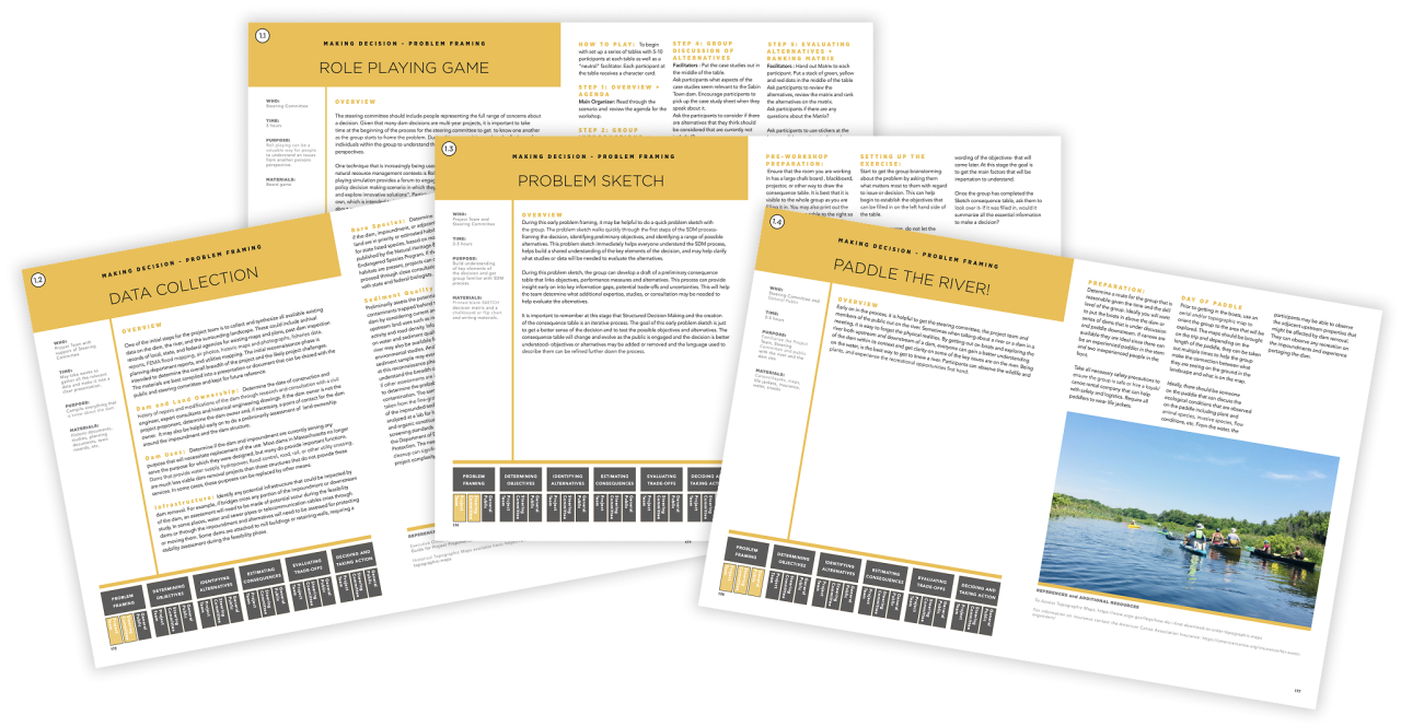
Case Study
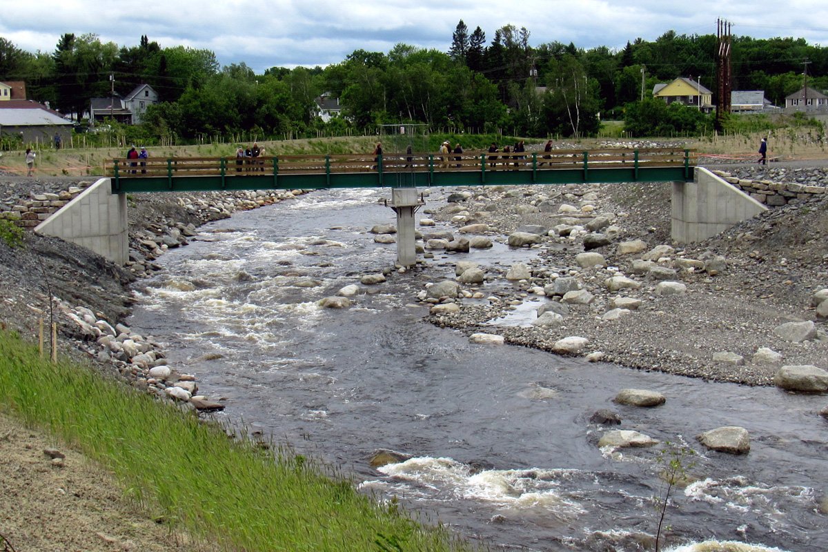
Within New England, many aging dams are in poor condition and require attention or repair. Each dam is unique—shaped by distinct ecological, social, physical, and economic factors that must be considered when exploring potential solutions. Because many of these aging dams are small and no longer serve their original purposes, there is often a range of viable alternatives that can meet multiple objectives.
Dam-related planning processes benefit from a structured exploration of known options—such as full or partial removal, construction of nature-like fishways, or rehabilitation—while also leaving space for creative, site-specific solutions that may emerge through community dialogue. The Dam Atlas compiles case studies from across the region to illustrate this diversity of approaches and to highlight how communities have weighed trade-offs and made decisions about the futures of their dams.
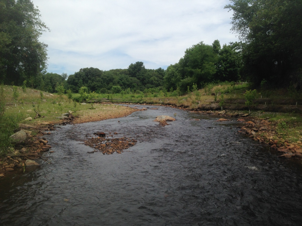
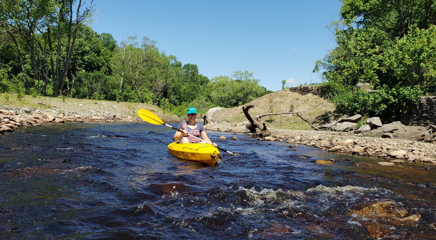
Dam removal provides full habitat connectivity and fish passage up and downstream. It eliminates the risk of dam failure and avoids long-term maintenance and repair costs. It represents a “one and done” solution to the many aging dams in the region. Removal also allows canoes and kayaks unobstructed passage downstream without the need for long and sometimes dangerous portages (carrying a boat around the dam).
Dam removal requires careful study and engineering to assure that neighboring infrastructure, such as bridges and roadways are not damaged by changes in the river channel. Studies are also needed to understand the impact of lowering the upstream water elevations on wells, upstream wetlands, recreation and private properties along the reservoir.
While dam removal can be expensive up-front, there is no long-term cost or maintenance required once the dam is removed.


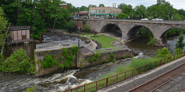
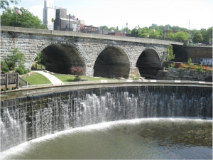
The stretch of the Cuyahoga River that ran through the defunct Kent Dam was cited for noncompliance with the Clean Water Act by the Ohio EPA for exceeding pollutant concentrations. The EPA informed the City of Kent that they must pursue a modification-removal of the dam or face more stringent permitting limits at the City’s Water Reclamation Facility. Because this permitting would be costly to Kent taxpayers and have little benefit to the quality of the river, the City of Kent began the processes of review and public engagement necessary to remove the dam with historic preservation.
Due to the potential conflict between historical preservationists and environmental advocates, the city created a 19-member Kent Dam Advisory Committee (KDAC). Their goal was to examine feasibility and decision-making pathways by studying factors like applicable laws and regulations, water quality issues, historical significance, and fish migration routes. After several meetings, the KDAC proposed a solution: the removal of a concrete wall that had been placed across the old lock area. This removal would allow water to flow around the arch dam, which would improve water quality and allow fish passage while maintaining the historic arch structure. Tannery Park was constructed surrounding the historic arch dam and a pump circulates water so water continues to flow over the front of the dam.
Due to the potential conflict between historical preservationists and environmental advocates, the city created a 19-member Kent Dam Advisory Committee (KDAC). Their goal was to examine feasibility and decision-making pathways by studying factors like applicable laws and regulations, water quality issues, historical significance, and fish migration routes. After several meetings, the KDAC proposed a solution: the removal of a concrete wall that had been placed across the old lock area. This removal would allow water to flow around the arch dam, which would improve water quality and allow fish passage while maintaining the historic arch structure. Tannery Park was constructed surrounding the historic arch dam and a pump circulates water so water continues to flow over the front of the dam.
By creating an advisory committee dedicated to research and resolution, the project team was able to reach a solution that met the needs of the environment as well as the citizens of Kent. Because so much national attention was focused on the project, early involvement spurred the Clean Water Act, strategies of engagement, analysis, and implementation; it even helped to inform similar projects across the country.
The Kent Dam is also a good example of a project that was able to achieve the dual goals of habitat connectivity and historic preservation. By creating a public park at the dam site, the history of the site and sense of place was able to be preserved and possibly enhanced. In addition, by adding a water feature to the arch dam artifact, the aesthetic and acoustic experience of being near a waterfall was preserved.
City of Kent: https://www.kentohio.org/409/Dam-Restoration-Project
The Head Tide Dam was constructed over 250 years ago to power a series of mills in Alna. The Jewett family donated the dam to the town in 1964. One of the main challenges in the project was deciding whether work could proceed due to a covenant in the deed stating the dam could never be destroyed.
To address the concerns about the legal deed covenant, the decision was made to partially remove the western portion of the dam. The partial dam removal and construction of the overlook platform – which maintained “one contiguous line from shore to shore” – was deemed acceptable by Alna selectmen and legal counsel as complying with the legal deed covenant. In addition, the partial removal maintained a portion of the historic structure as a landmark for the community.
The partial removal of the Head Tide Dam is a good example of the ability to think and work creatively to address legal limitations on a project. It also was successful in providing habitat connectivity as well as preserving the historic dam structure that was important to the community.
The partial removal of the Head Tide Dam dam resulted from a strong team that worked on the project. The restoration team did not go into the community with a preconceived idea of what needed to happen but rather worked with the community to decide how to improve fish passage and river connectivity.
Just because there are legal challenges or deed restrictions on a dam, doesn’t mean that modifications can not be made to a dam. This project highlights the opportunity to think creatively to work through legal challenges and deed restrictions.
https://atlanticsalmonrestoration.org/projects/magic-on-the-river
https://lcnme.com/currentnews/work-starts-at-head-tide-dam-in-alna/
https://lcnme.com/currentnews/head-tide-dam-project-a-gift-thats-going-to-outlive-us-all/
Because multiple dams (West Brittania, Whittenton, and Morey’s Bridge) were involved in this project, each had its own set of challenges.
In response to the near dam failure, risk posed to the surrounding communities, and an effort to reconnect the area to the Wild and Scenic Taunton River, three dams were removed over a series of years( Hopewell Mills in 2012, Whittenton in 2013, West Britannia in 2018). Morey’s Bridge Dam was left in place, but a fish ladder and eel ramp was installed in 2012 as part of a bridge restoration project through the Department of Transportation.
With a release of natural sediment held back by the dams, the river has begun to restore its natural channel, with increased biodiversity, and recreational access from the Narragansett Bay to the headwaters of the Mill River. The dam removals and reconstruction restored fish passage to 30 miles of habitat in the Taunton Watershed. River herring and sea lamprey have been reported in the area for the first time in 200 years. The project has also improved recreational access and reduced flooding threat to local communities--and has spurred secondary projects like the Weir Village Riverfront Park, which provides a waterfront walkway, boat ramp, and fishing pier.
The near-failure of the Whittendon Dam highlighted the dangers of neglected historic dams. Repairing the Whittenton Dam alone would have cost an estimated $1.9 million. The cost of removing the dams, restoring the river, and reducing dangerous hazards was far less costly and provided more beneficial outcomes for local residents and habitats along this stretch of the Mill River.
The Mill River Dams are a good example of the benefit of taking a “river approach” to addressing dams to improve habitat connectivity. Rather than only repairing or removing the failing Whittenton Dam, the team used the crisis as a catalyst to address multiple decaying dams along the Mill River and as a result were able to improve habitat connectivity along 30 miles of the river.
Nature Conservancy: https://www.nature.org/en-us/about-us/where-we-work/united-states/massachusetts/stories-in-massachusetts/mill-river-restoration/
MASS DER: https://www.mass.gov/service-details/mill-river-restoration#:~:text=The%20Hopewell%20Mills%20Dam,constructed%20at%20Morey’s%20Bridge%20Dam.

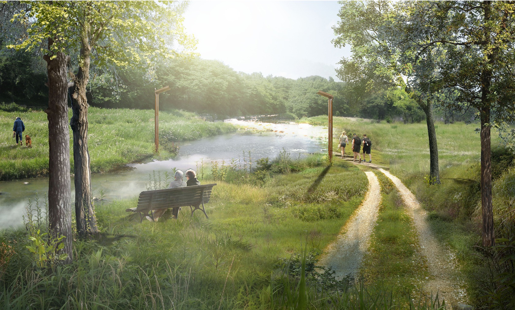
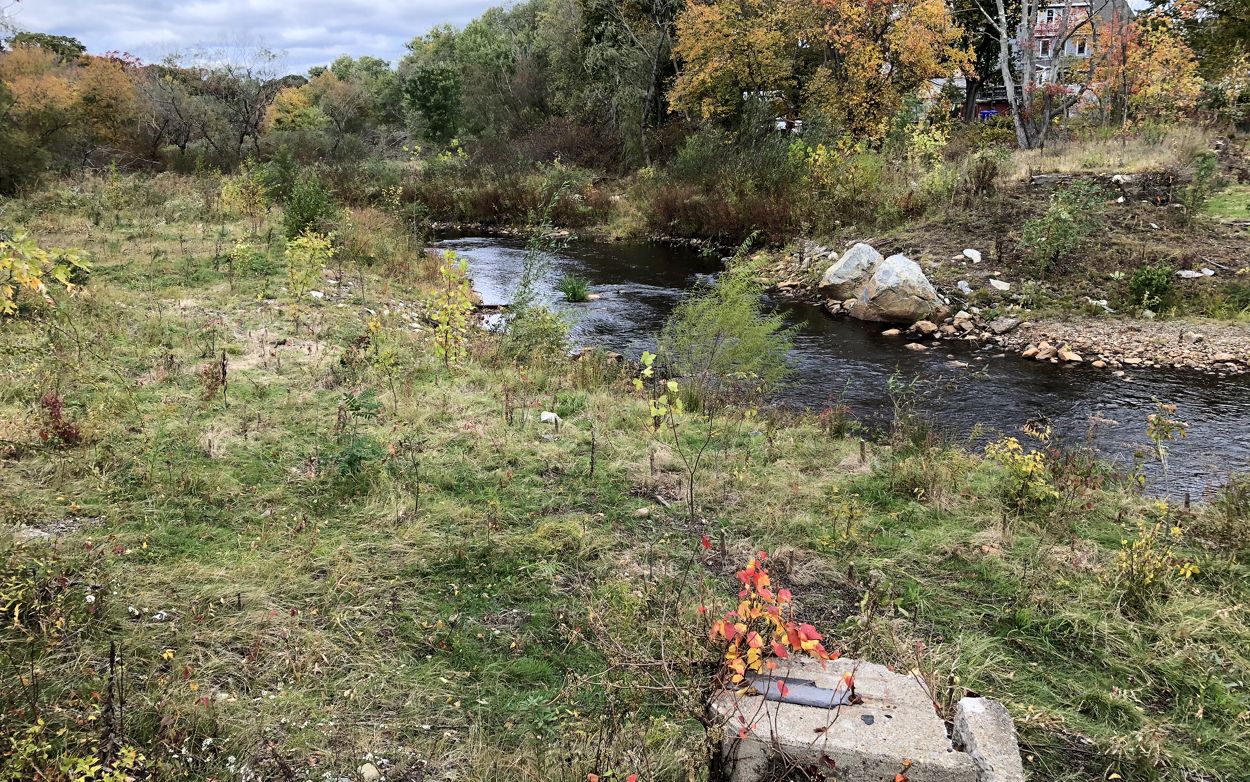
When dams are being considered for removal that are owned by state or local governments, there may be the possibility that removal can provide new public spaces adjacent to the river. These public spaces can provide public access to the river such as new walking trails, boat ramps, or fishing docks and help create or maintain a sense of place even if the landscape is changing. Landscape architects on the project team can work with the community to envision and design the future of public access to the surrounding landscape. On some sites that are being considered for removal, the dam may be perceived as an important part of the local landscape and cultural history. There are design strategies that can help maintain a sense of place and/or preserve portions of the historic structures while restoring a free-flowing river.
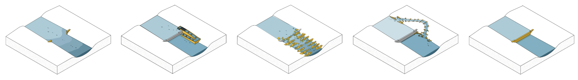
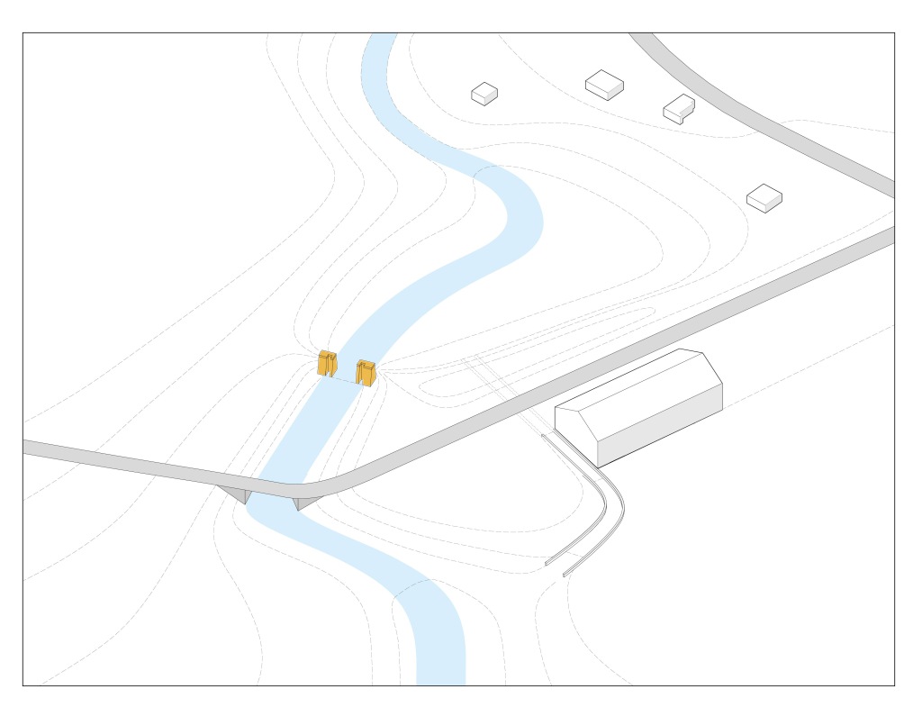
Following are diagrams showing speculative ideas for how to design a site post dam removal.
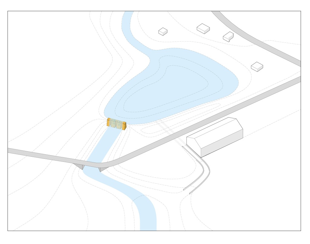
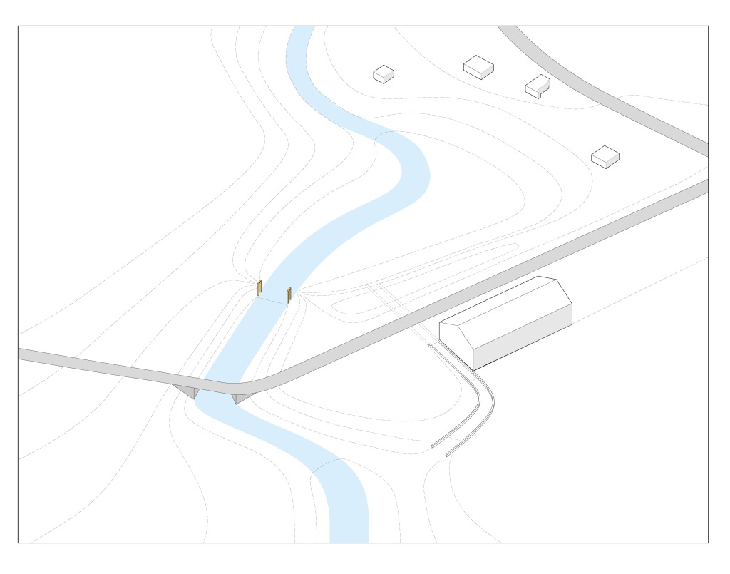
EXISTING CONDITIONS: Diagram of Existing Conditions – Dam and impoundment before removal.
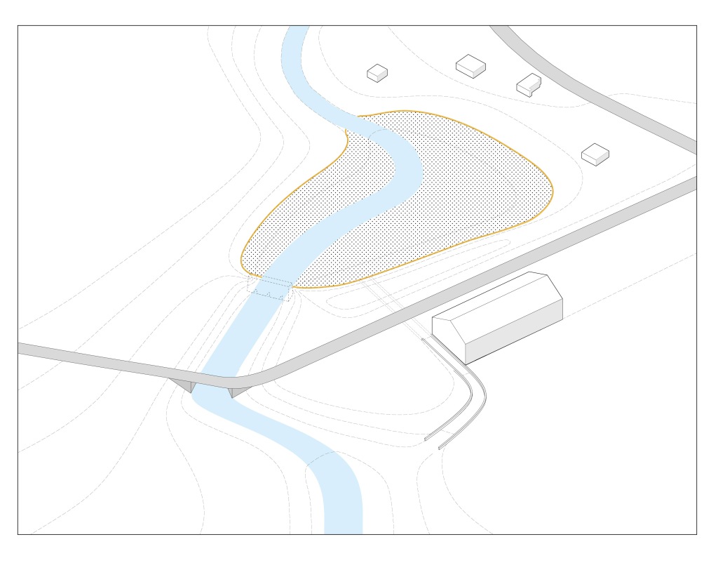
PUBLIC OPEN SPACE: The area that was the impoundment can be a new public space and maintained as a wet meadow to ensure views across the historic impoundment are maintained.
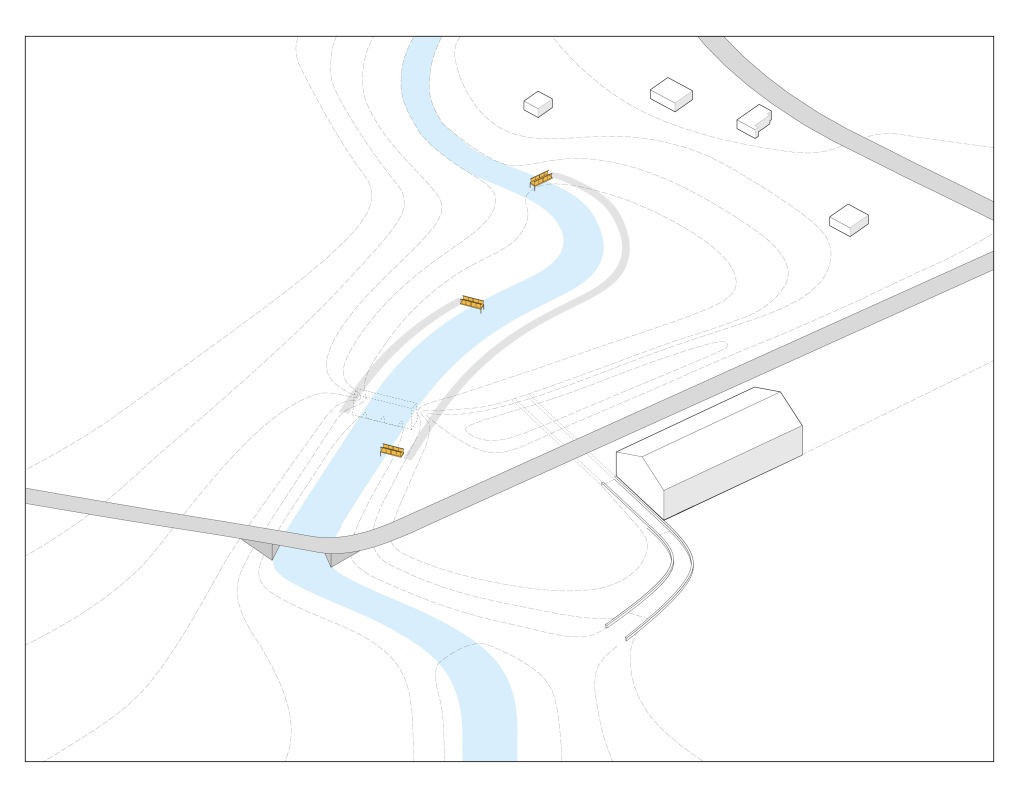
FISHING ACCESS: Fishing docks or rocks can be installed along river to improve fishing access and improve recreation.
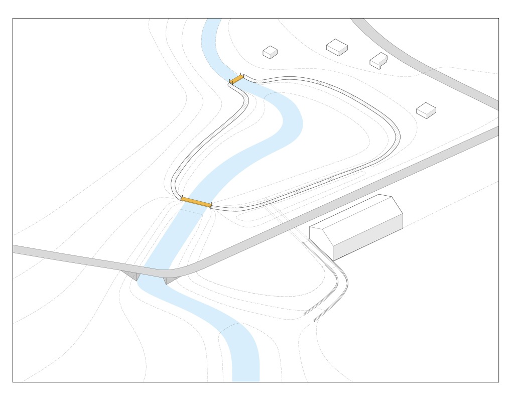
PATHS: Path can mark the location of the historic impoundment or provide trails to acccess the floodplain.
PUBLIC ART: Public Art sculptures can be installed to mark the historic location of the dam.
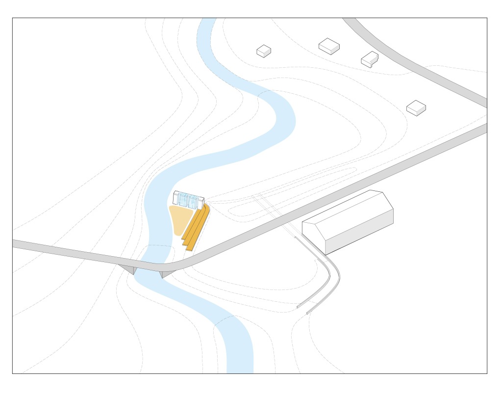
PUBLIC GATHERING SPACE: River can be diverted around the historic dam. A public gathering space can be constructed adjacent to the historic structure and a water feature installed to maintain the aesthetics of the waterfall.
HISTORIC STRUCTURE: A portion of the dam can remain to mark the historic location and honor the history of the dam.
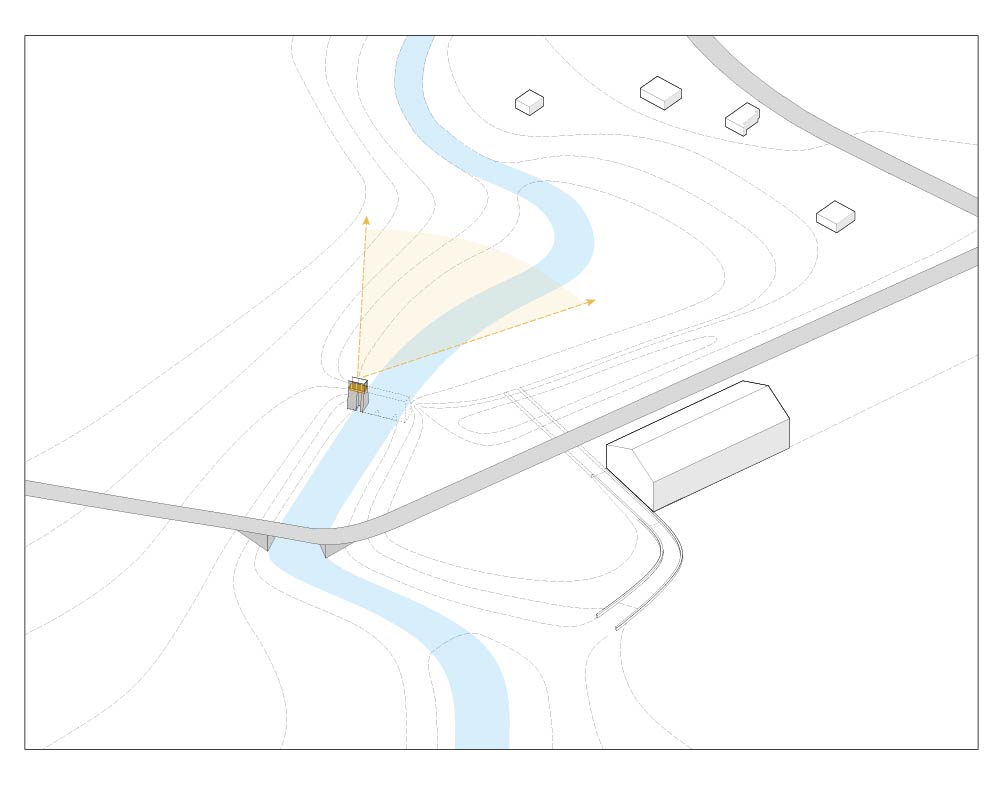
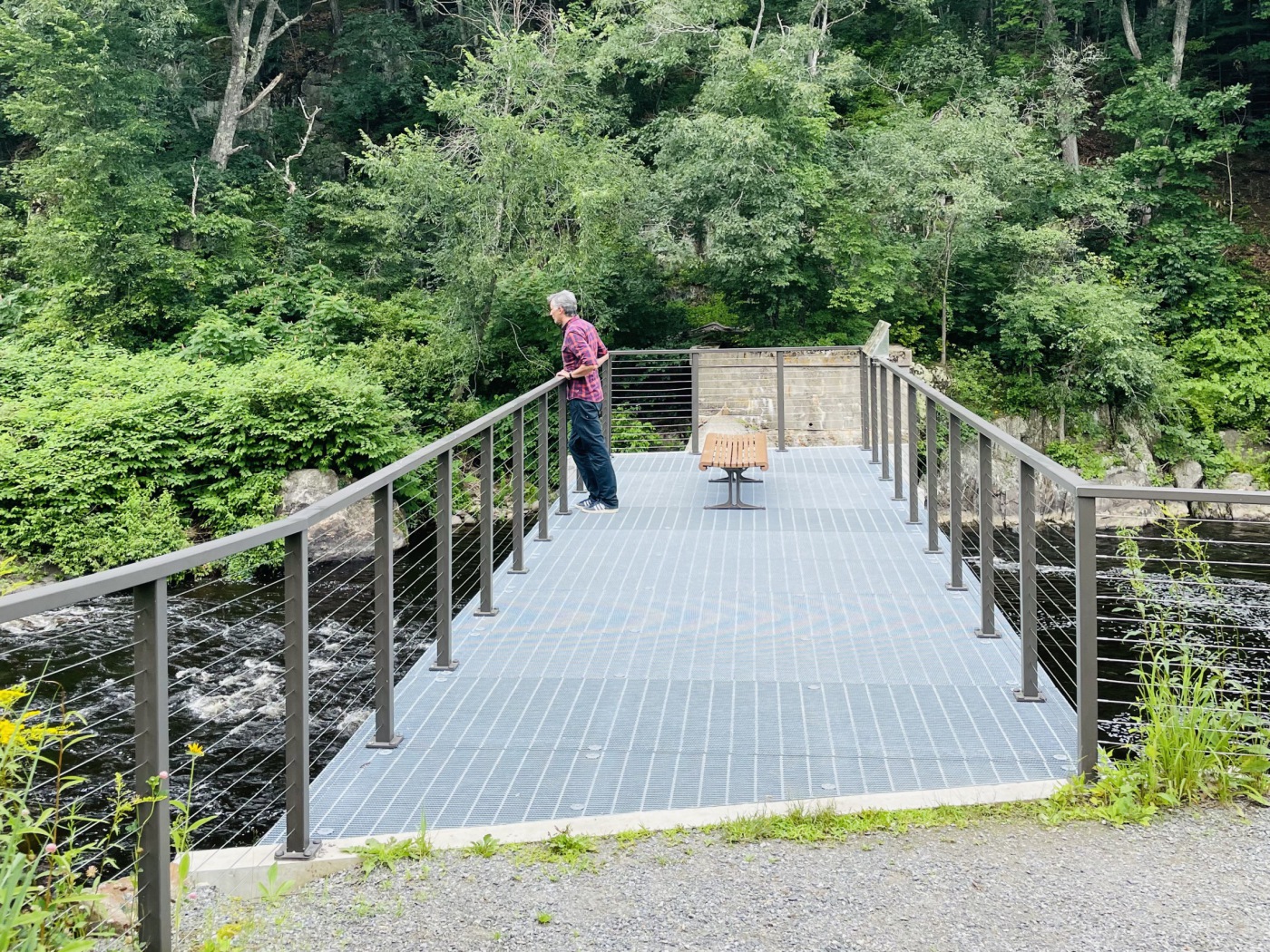
OVERLOOK: An overlook can be constructed on top of the historic dam structure to provide views of the river.
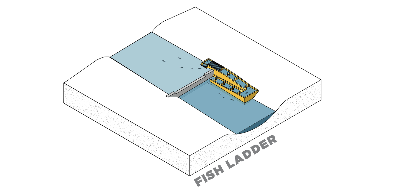
A conventional fishway, commonly nicknamed “fish ladder,” is a structure that is built alongside an existing dam that is intended to provide a corridor for aquatic species to swim up and over the dam barrier, then back down. Conventional fishways may be an option where there is a desire to provide some fish passage without removing the dam. Selecting the most appropriate fishway for a given project will depend upon the slope, budget, flow conditions, and target species.
Those unfamiliar with fish ladders may be surprised at the complexities and challenges that must be overcome for these to function well with a variety of species (e.g., river herring, shad, eels) and life stages (juvenile vs. adult). Fish vary dramatically in their swimming speed, stamina and leaping ability. The slope, turbulence, placement of resting areas and other design features are essential elements. Unfortunately, a “one-size-fits- all” approach with fishways rarely works. In addition, fish seek particular velocities and pathways through a river channel as they move upstream. If the entrance placement and water flow out of a fish ladder does not match preferred conditions, migrating fish will not use the ladder and can mass in huge numbers at the base of a dam – negating the entire fish ladder. The design of fish ladders that will accommodate multiple fish species and life stages is not yet a mature science and many fish ladders require costly alterations after construction.
If a dam has received a letter of deficiency, the dam would need to be repaired prior to constructing the fishway. In addition to this upfront cost, this scenario requires long-term maintenance of the dam and the fishway. Conventional fishways vary in cost, aesthetics, and performance depending on the design and dam structure. They are not inexpensive and frequently cost upwards of half a million dollars.
There are 3 general types of conventional fishways found within Narragansett Bay Watershed: Denil fishway, Alaskan steeppass fishway and Weir and Pool fishways.

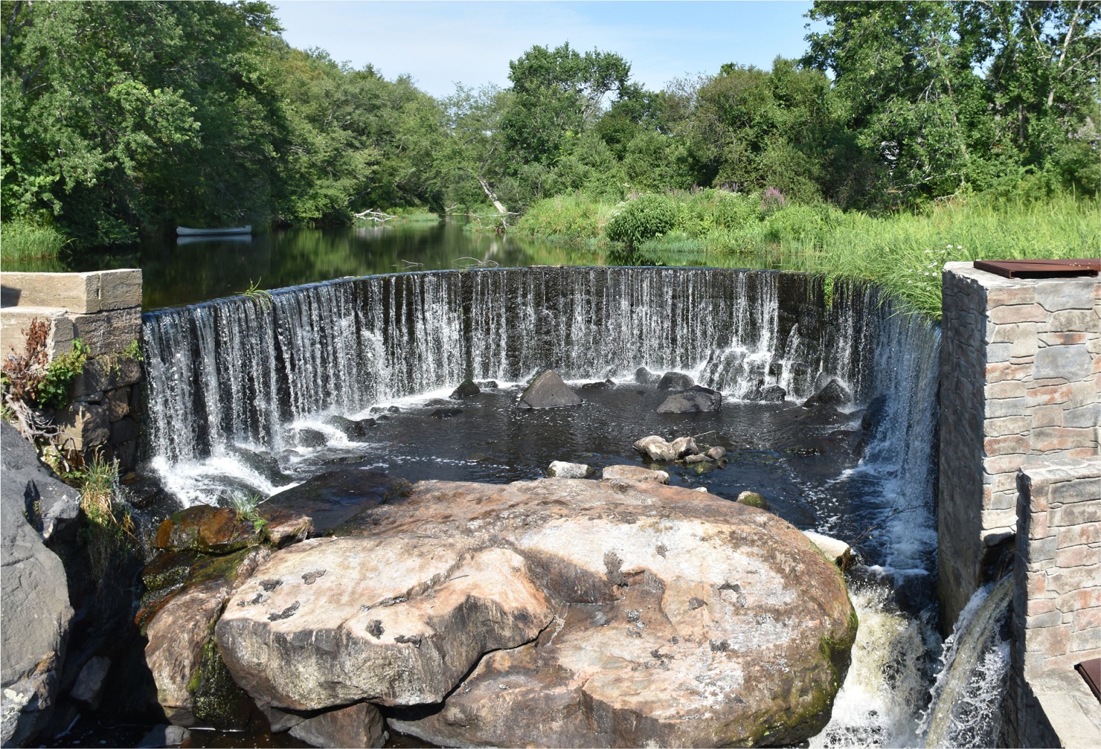
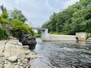
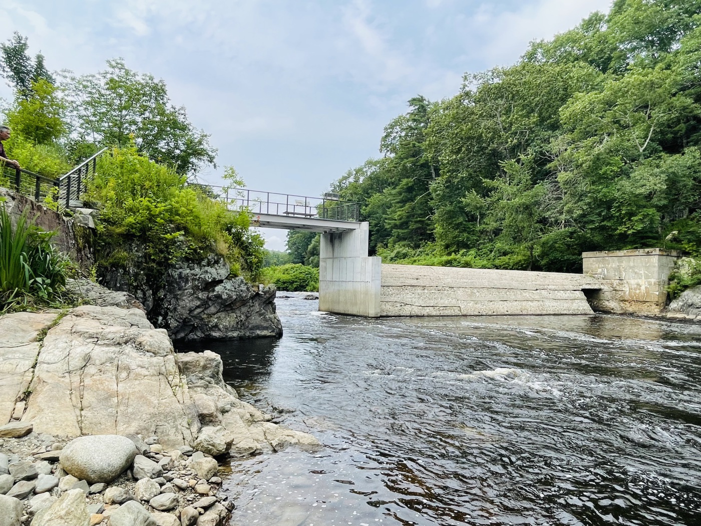
Removal of the dam was challenged as the Horseshoe Falls Dam was a local landmark widely appreciated for its scenic beauty. It is the only horseshoe-shaped falls in Rhode Island. Many perceive Horseshoe Falls Dam as an historically significant part of the state’s industrial heritage.
Due to the dam’s scenic beauty and historical importance, the restoration project required sustained outreach to ensure all stakeholders were heard and all interests were met. An elaborate state of the art Denil fishway was designed to allow alewife and eel passage. To ensure the fishway did not look out of place, engineers shaped the exterior of the fishway to match the stones of the original mill foundation on the opposite bank.
This project was able to meet the dual objectives of improving fish passage and the preservation of the historic arch dam structure.
The Horseshoe Falls Dam fishway project demonstrates that there is room for flexibility in discussions between dam removal and historic preservation. Creative alternatives can achieve project goals like fish passage without compromising the aesthetic of a cherished landmark.
Wood Pawcatuck Watershed Association’s presentation:
http://www.wpwa.org/documents/WPWA%20Horseshoe%20Presentation.pdf

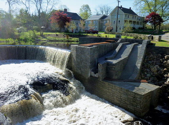
The original fish ladder was a series of small pools connected by short passages that raised over 42 feet from the bay to the impoundment. The fish ladder worked well for about 180 years but its stonework and the underlying concrete deteriorated as ice dislodged stones and blocked the path for the fish. By the 1990s, the fish ladder was in very poor condition, and fish count plummeted to less than 200,000.
With strong community organizing, and fundraising, the reconstruction of the fish ladder began in 2007. The redesign and reconstruction of the fish ladder is similar to that of the original, consisting of a series of 69 ascending pools connected by weirs, or short waterfall passageways that each rise 8-10 inches. The reconstruction took over 10 years and could only take place from November - April to avoid spawning season. In April every year, the construction team had to stop so the ladder could be used for the spring migration. The renovated ladder winds 1,500 feet up the hill and was reconstructed using the original stones and designed to weave around mature trees that shade the pools.
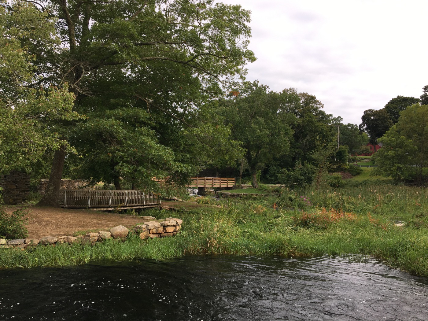
The lower pools are publicly accessible and include a boardwalk and signage. The upper portions snake through residential backyards before reaching the lake.
At the lower end of the pools, a set of “dippers” and troughs, allow for the towns to harvest alewife. The harvested alewives are used primarily as lobster bait however a few bushels are smoked and sold for human consumption. All funds received for harvested alewives are spent to maintain and restore the fish ladder and harvesting area.
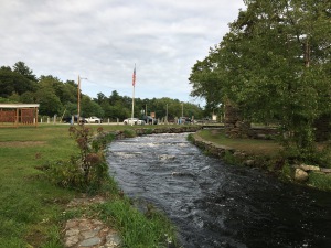
Following the restoration, more than one million alewives pass up the fish ladder to spawn each spring making the Damariscotta river one of Maine’s oldest and most productive alewife fisheries.
Community support has been key to the restoration of the fish ladders. An annual Herring festival took place from 2007 until the pandemic and helped raise funds and support for the restoration. Currently the community group is raising funds to replace the boardwalk and foot bridges . Volunteers are present at the Fish Ladder on May weekends to welcome visitors, and sell tee shirts caps and other Fish Ladder. In addition, fundraising takes place at community events such as a silent auctions, an annual “Alewife run” and concerts.
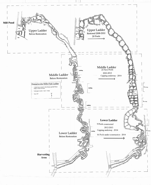
Plans of the fish ladder before and after restoration.
https://damariscottamills.org/
https://www.atlasobscura.com/articles/fish-ladder-maine-lobster-industry

The mill and dam remained in a state of abandonment until the 1960’s, when Oliver Mill Park was opened surrounding the dam and historic industrial ruins. Herring populations in the Nemasket River declined dramatically during this time, with a mysterious die-off event in 1965. Low water levels and invasive plants exacerbated the issue and prompted proposals to reestablish fish passage on the river.
The fishways at Oliver Mill were initiated by an effort to restore the ecological and cultural heritage of the Nemasket River. During the 1960’s and 1970’s the site was partially restored for recreation, fish passage, and to preserve the industrial archeological site. During this time, two stone fish ways were installed. In 1982, the Massachusetts Division of Marine Fisheries built a new stone and concrete notched weir-pool fishway. In 1996 the Middleborough-Lakeville Herring Fishery Commission was created to administer and enforce herring harvest regulations, maintain and enhance herring habitat, and public education on the herring run.
The Nemasket River is relatively short (11.2 miles) with only 3 dams between the ocean and the 1,721 acres of prime spawning grounds of the Assawompset Ponds. Taking a whole river approach, fishways have been constructed at all three dams, allowing fish passage into the ponds. In 2013, almost one million herring were able to pass through the fishway at Oliver Mill to spawn in Assawompset Pond!
The communities of Middleborough and Lakeville have been shaped by the abundance of herring in the Nemasket River. In addition to the ecological value of the annual hearing run, it is also an important social and cultural event. Community support to preserve the yearly fish run helped to spur the restoration of the river and the fish migration. Since 2013, local and state Cultural Councils and the Middleborough Tourism Committee have hosted the Annual Herring Run festival to bring the community together to celebrate the fishrun. These celebrations help to reinforce the relationship between the community and the herring, ensuring the herring remain an important part of the local identity and helping to spur continued stewardship and involvement in preserving and improving the annual fish runs.
This case study is also an example of how a fishway can be integrated into a public park to achieve multiple objectives. With the creation of the Oliver Mill Park, the project was able to achieve the shared goals of improving fish passage, providing recreation, and preserving history. The fishways are integrated into the design of the park allowing the fishruns to be highly visible. Oliver Mill park provides paths for visitors to see the historic stone mill ruins and bridges that cross the multiple river channels and allow visitors to see the herring run below. In 2000, Oliver Mill Park was listed on the National Register of Historic Places as the Muttock Historic and Archeological District.
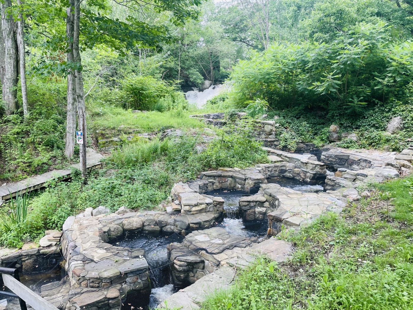
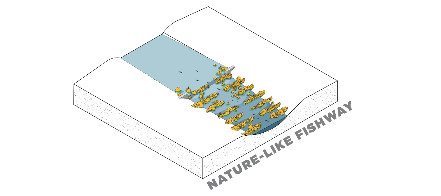
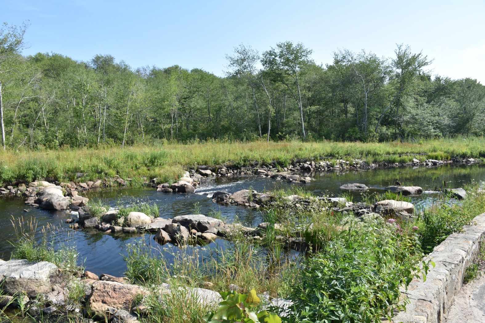
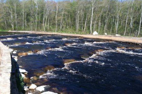
A nature-like fishway resembles a natural river with a series of pools and riffles. It consists of a wide, low-gradient channel that is constructed with rocks and boulders that are gradually terraced to make up the height difference between the below-dam and above-dam elevation. Boulders in the channel create multiple pathways that vary in length and velocity to allow multiple fish species to swim upstream. Because nature-like fishways are wide and gradual channels, they also provide improved fish habitat connectivity up and downstream. Nature-like fishways may be suitable for low height obstructions, where upstream water level control is not essential, and if there is a need or desire to preserve the upstream impoundment due to recreation, well water, contaminants or habitat. Nature-like fishways vary in cost, aesthetics, and performance depending on the design and dam structure.
In this scenario, the river downstream of the dam is gradually raised to the elevation of the dam across the whole river channel through a series of rock/pools. Because the fishway spans the whole width of the river channel, the dam is no longer visible. In this scenario, there needs to be sufficient space downstream to build up the channel gradually to the height of the dam. Frequently, the dam is partially lowered to reduce the elevation the downstream channel has to be raised. In addition to full width nature-like fishways, there is an option for partial width fishways that only extend across a portion of the river width.

The neighboring community did not support full dam removal due to concerns about the impacts of lowered water levels on residential wells upstream. In addition, Kenyon Mills owned the dam and was willing to have it removed, but needed the impoundment for fire suppression.
Construction crews implemented a partial dam removal and installed a rock ramp, or nature-like fishway spanning the full width of the river channel. The dam height was lowered and a rock ramp was constructed to create the riffles and flow necessary to sustain fish passage with a gradual incline in elevation.
Creating a nature-like fishway provided fish passage while allowing for the impoundment to remain upstream, providing water for fire suppression and ensuring that the upstream wells would not lose drinking water. In addition, during low flow, the rock ramps provide diverse habitat along the river’s edge.
Wood Pawcatuck Watershed Association’s presentation: http://www.wpwa.org/documents/KenyonPublicPresentation%20(3).pdf
Turek, J., A. Haro, and B. Towler (2016). Federal Interagency Nature-like Fishway Passage Design Guidelines for Atlantic Coast Diadromous Fishes. Interagency Technical Memorandum.
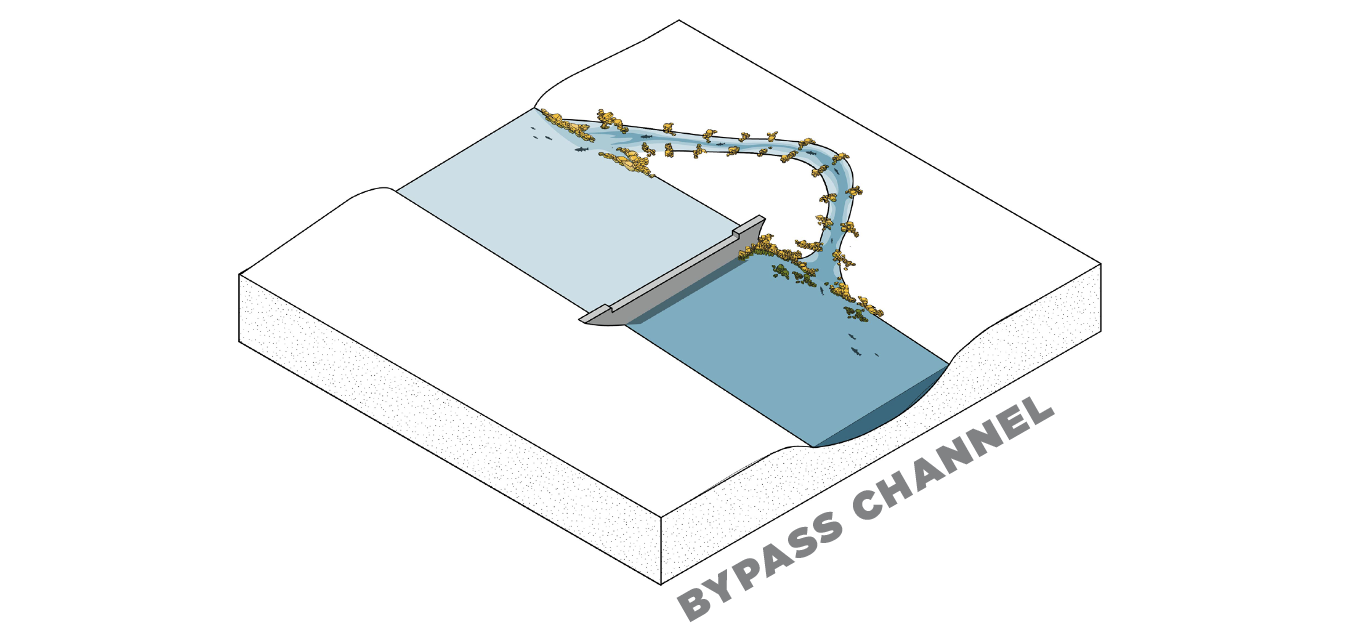
In this scenario, a new channel is constructed to bypass the dam and connect the river upstream of the dam to the river downstream of the dam. This alternative requires that there is land adjacent to the dam where a channel can be excavated and graded using the rock/pool strategy. It is a good alternative to consider if the dam is a historic structure or there is the desire to protect views of the dam structure itself. If a dam has received a letter of deficiency, the dam would need to be repaired prior to constructing a by-pass channel. In addition to this upfront cost, this alternative requires long-term maintenance.

Because the Howland, Great Works, and Veazie Dams once generated hydroelectric power, production would need to be shifted elsewhere. The river also experienced dramatic variations in flow, necessitating careful monitoring of volume and velocity to prevent flooding.
The project team ensured that hydroelectric energy production could continue by strategically decommissioning the existing facilities and implementing system upgrades at six other sites. These upgrades resulted in as much hydropower production as before the dam removals. A nature-like bypass channel was designed to resemble a natural stream, reflecting ideal conditions for migratory species. In order to re-grade the sloped site into a channel, bedrock was blasted and strategically placed throughout the stream bed to create roughness and water perturbation critical to the health of migrating fish.
This project was the first large-scale natural fish passage channel of its kind, allowing for a restored Salmon run up the Penobscot River. Its complex construction accommodates a wide range of flow volumes and velocities. Overall, the Penobscot River Restoration Project restored nearly 2,000 miles of historic river habitat.
PENOBSCOT RIVER RESTORATION TRUST: https://www.nrcm.org/wp-content/uploads/2016/06/Howlandbypassfacts.pdf
For social, economic, and/or environmental reasons, keeping and repairing a dam is sometimes the option selected for a dam and its community. Some reasons a dam may be preserved include: the presence of contaminated sediment behind a dam; the dam is listed on the national registry of historic places; rare or endangered species are found in the upstream impoundment; and there are multiple dams downstream that block fish passage. Depending on the location of the dam within the watershed and the importance of fish passage, repairs to the dam can be combined with other fish passage structures. For example, if a dam is located in the headwaters (upstream) where anadromous fish passage is not a priority and where the cost of providing fish passage is very expensive, the decision may be made to just repair the dam. However, if the dam is located close to where the river meets the ocean and providing fish passage is a priority but removal is not possible, the dam may be repaired and a fish passage structure may be added. If the decision is made to keep a dam, structural deficiencies must be addressed through repairs and future inspection and maintenance needs to be factored into cost estimates.
With dam repair, the structure of the dam would remain and the existing surrounding ecology would be unaffected. However, unless fish passage structures are added, there would be no fish passage or habitat connectivity above this dam. And while this may be one of the least expensive alternatives in the short term, this alternative requires long-term maintenance so cost over time needs to be considered.

New England is home to more than 14,000 dams, many of which are small, “legacy” structures built over a century ago. Most no longer serve their original industrial purposes and are reaching the end of their useful lives, raising concerns about safety, maintenance, and ecological impacts. These aging dams can threaten downstream communities, especially as climate change brings more frequent and intense storms. While dam removal is often advocated for ecological, economic, and safety reasons—such as restoring fish passage, water quality, and sediment flow—many communities feel a strong attachment to their local dams. Dams and their impoundments have become part of the landscape, local history, and sense of place, sometimes even serving as town landmarks or symbols of cultural identity.
The goal of this website is to share this work and support communities who are making decisions about the future of a dam. Decisions about dams are inherently complex and require the consideration of ecological, social, safety, and economic trade-offs. While there are many great resources and publications for proponents of dam removal, this website aims to provide an unbiased source of information on the ecological and social considerations associated with dam decisions. Rather than advocating solely for removal, the goal of this approach is to bring a community into an open conversation to think creatively about the future of a dam. While this may seem counterintuitive if your role is to advocate for dam removal, engaging communities in an open but structured discussion about the future of a dam has the potential to lead to better environmental outcomes and a community that has more ownership, connection, and sense of stewardship over their river. In addition, this approach has the potential to address what are often perceived as unequal power dynamics between dam removal proponents and the local community, which has led to projects stalling or failing in the past.
This website consists of four main sections: The first chapter, “Understanding Dams,” introduces key ecological, social, infrastructural, and economic factors that are important to consider for the management of dams at the individual and watershed scale. The second part, “Scenarios & Case Studies,” looks at various alternatives for the future of a dam and presents a series of case studies of projects throughout the region. The third chapter, “Making Decisions,” shares methods, ideas, and tools for how to engage in conversations about the future of a dam. The last section, the Interactive Dam Atlas, was developed in collaboration with faculty from the University of Rhode Island and helps to visualize and build a geographic understanding of dams in the Narragansett Bay and Rhode Island coastal watersheds.
While this Dam Atlas is focused on dams in the Narragansett Bay and coastal watersheds of Rhode Island, the metrics calculated in the GIS analysis can be applied to other watersheds, and the decision-making tools are not region-specific. By sharing our methods and the open-source decision support toolkit, the aim is to help support practitioners and communities that are looking for ideas, methods, and techniques for having discussions about the future of a dam. We encourage others to use, test, modify, evolve, and share these methods. Ultimately, the goal is for this work to contribute to a “library of approaches” that are openly shared to build knowledge and techniques to support collaborative environmental decision-making around dams.


This project is a collaboration between CommonPlace Landscape and Planning, The Rhode Island School of Design, and The University of Rhode Island with generous funding from the USDA Natural Resources Conservation Service, the National Science Foundation, Rhode Island Sea Grant, and the Blackstone Watershed Collaborative.
Project Vision and Content by Emily Vogler, GIS Analysis by Jason Parent, Content support by Art Gold and Ben Bailey, Website by Tanager Creative, Interactive Map Design and Development by Rubén Rodríguez.
Subscribe for periodic updates related to the Dam Atlas
"*" indicates required fields