A guide for community decision making around aging dams
Download the full Dam Atlas Publication
Download PDFIntroduction 1,000 Crumbling Dams
The Dam Problem We Can’t Ignore
By Emily Vogler
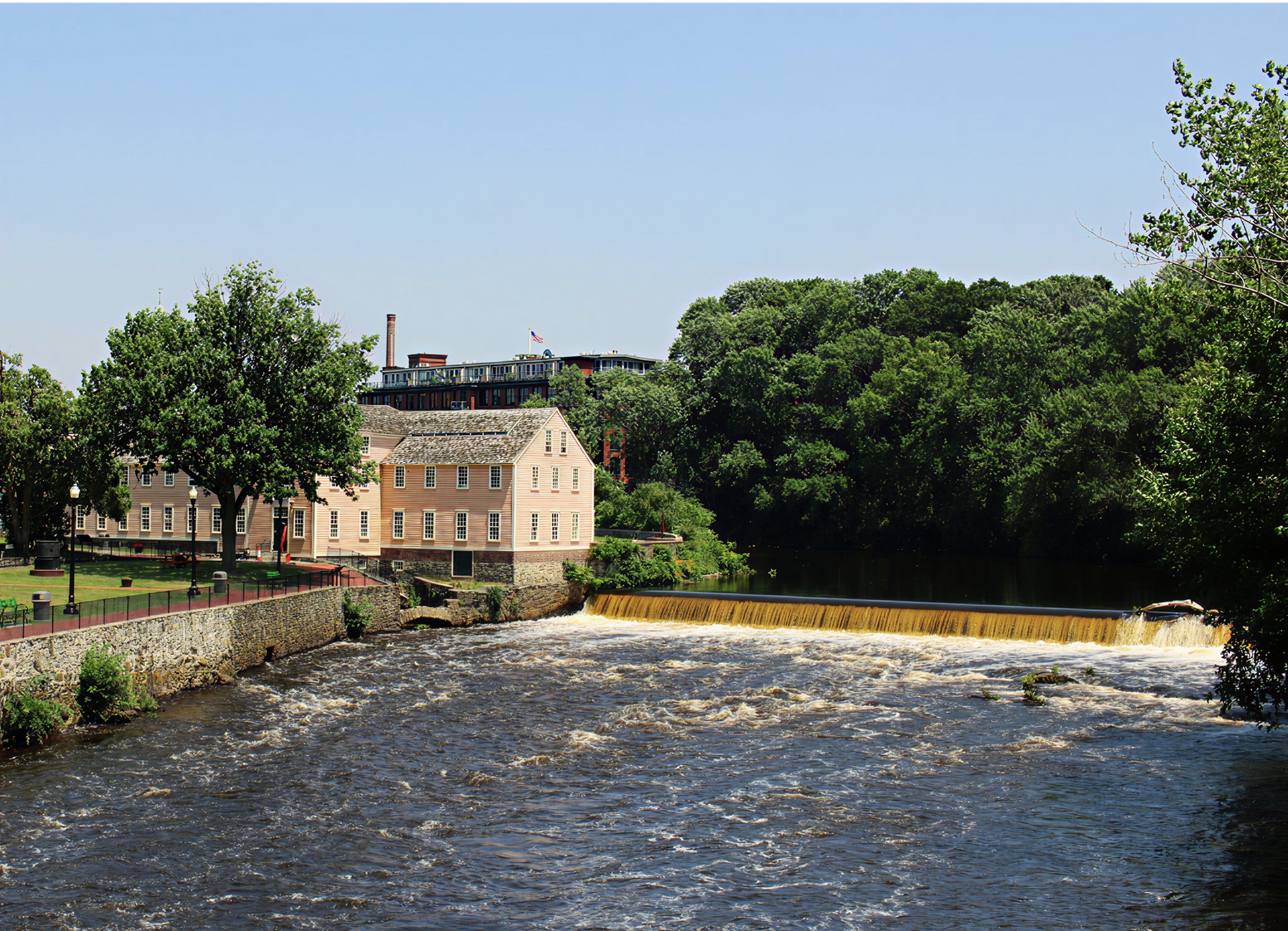
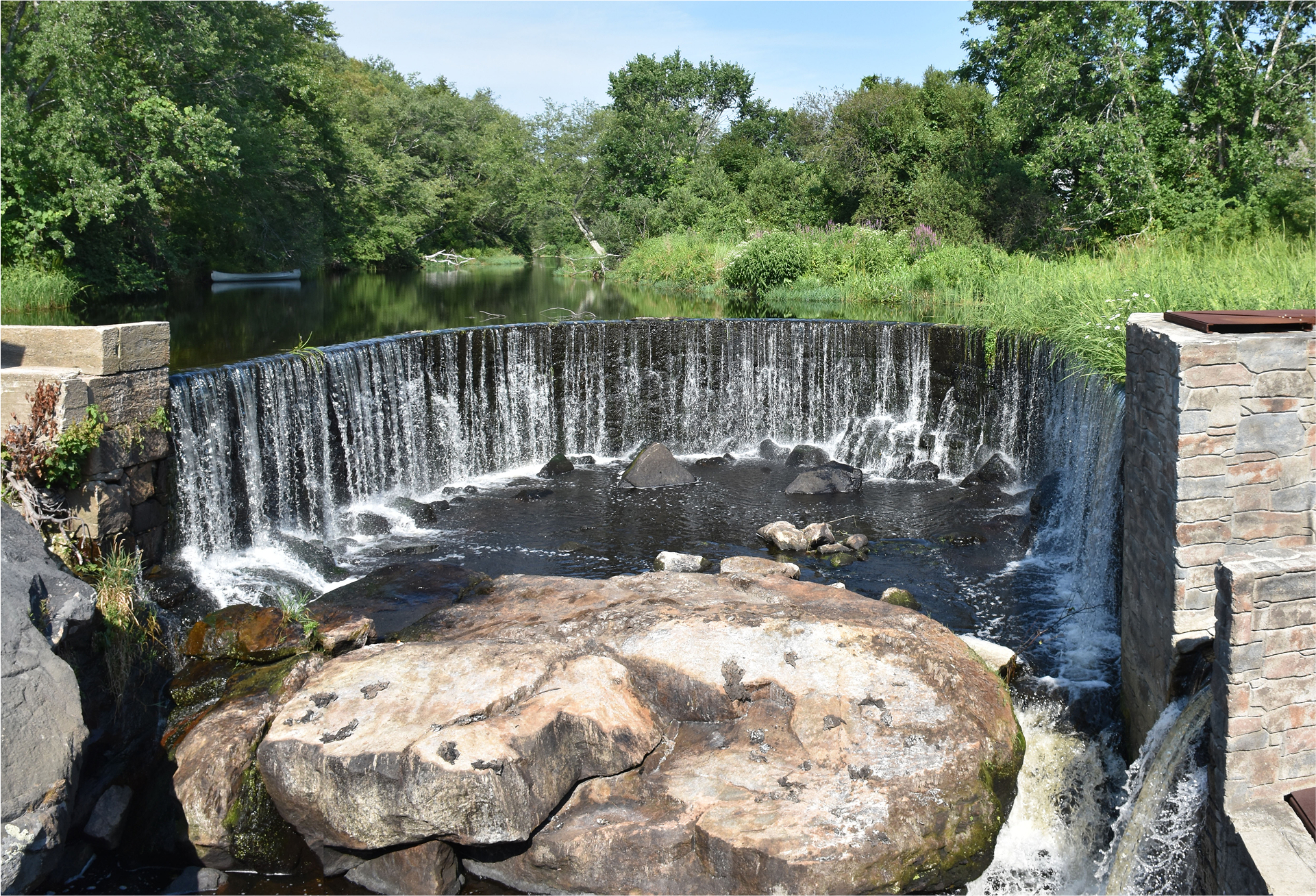
Each year, I paddle the Blackstone River with fellow advocates to take stock of the river’s health and to renew our shared commitment to restoring its ecosystems and strengthening community connections to the river. As we paddle down the river, we have to pay close attention to both our surroundings and the water ahead. Over the river’s 48-mile course, there are 21 dams, along with the remnants of many more. As the current slows and pools behind each dam, we must carefully scout how to navigate around these often-dangerous structures. Some dams, like Saundersville, are deep in the forest—partially breached but still fragmenting the river, blocking the passage of paddlers and aquatic species. To portage this dam, we use ropes to lower our boats down the face of the 15-foot-tall granite step dam. With no known owner, who should be responsible for its removal? Further downstream, we carry our boats around the improved portage at Albion Dam, which has recently been retrofitted as a micro-hydro facility. Millions of dollars were invested to restore this aging dam in an effort to reduce dependence on fossil fuels. Yet, due to the river’s small size, the dam generates enough energy to power only about 300 to 400 households annually. Near the river’s mouth, in downtown Pawtucket, stands Slater Mill—a historic dam built in 1793 as the first successful water-powered textile mill in the United States. Now a popular tourist destination, it draws thousands each year to the “birthplace of the American Industrial Revolution.”
We take out at Slater Mill because another dam lies just 300 feet downstream. The Main Street Dam, known as the “head-of-tide” dam, marks the divide between the freshwater river and the tidal estuary of Narragansett Bay. Built atop a historic waterfall that was once a prime fishing ground for the Narragansett, Nipmuc, Wampanoag, and Pokanoket tribes, the dam now prevents all migratory fish—including American shad, alewives, blueback herring, and Atlantic salmon—from swimming upstream each spring to reproduce in freshwater.
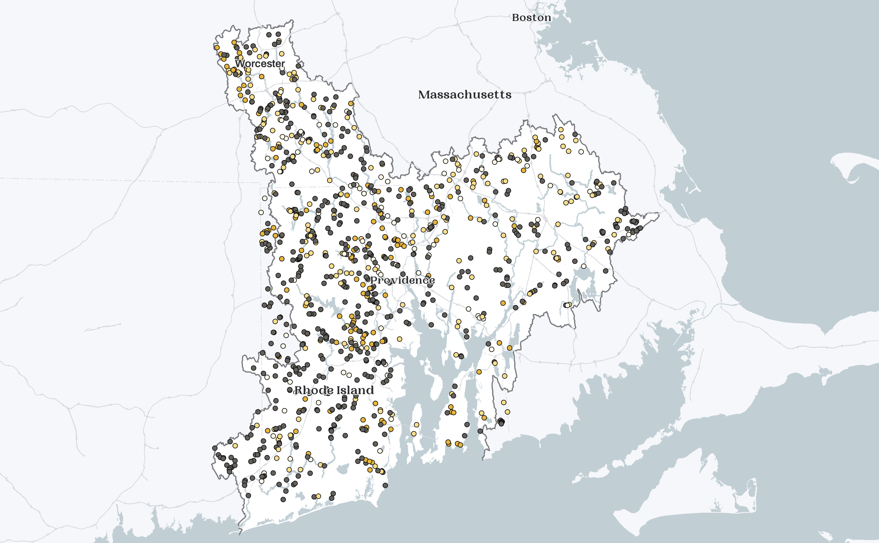
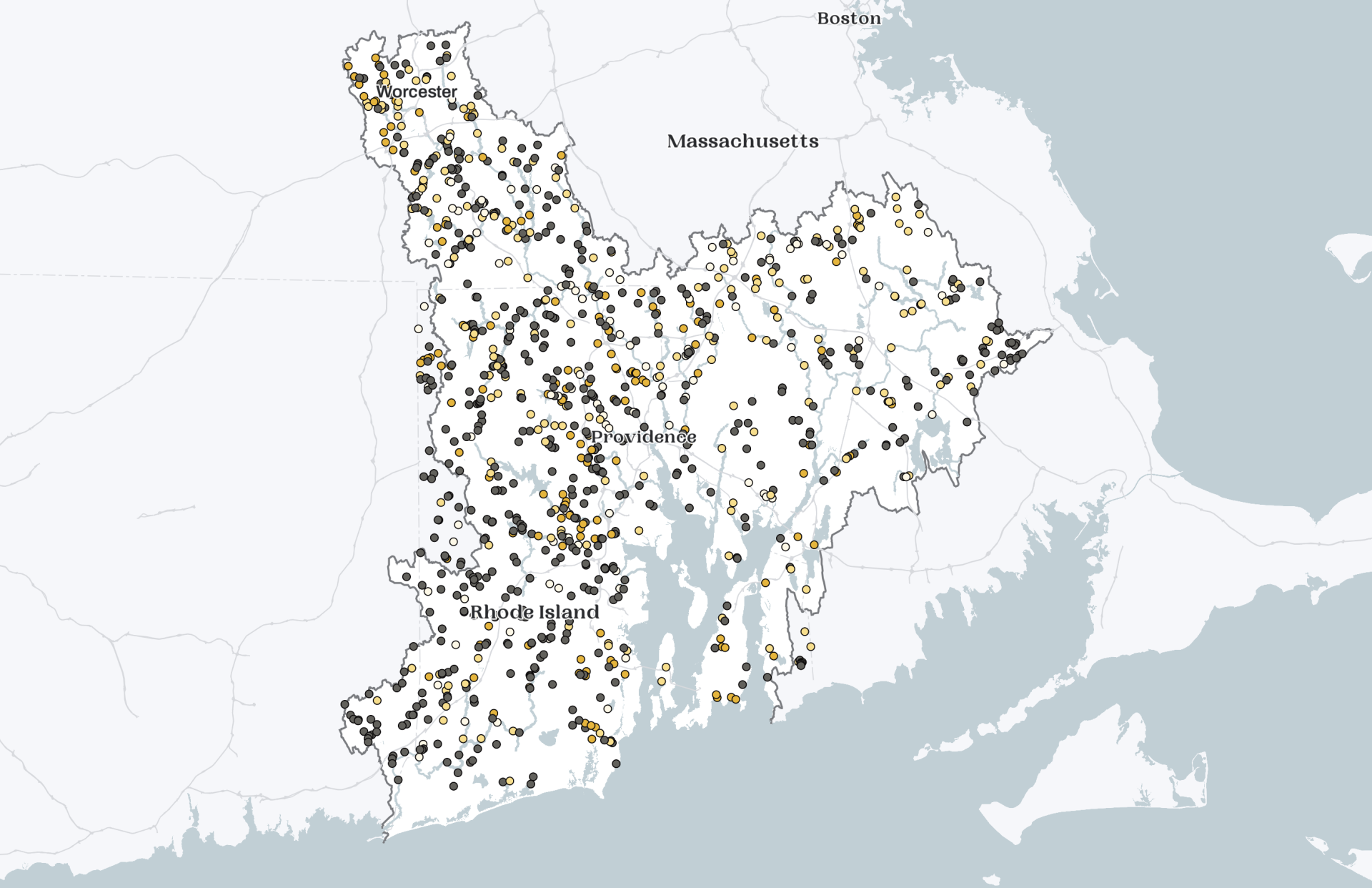
These are just a few of the 1,034 documented dams in the Narragansett Bay watershed and the coastal watersheds of Rhode Island. Similar to the 14,000 dams that punctuate the rest of the New England landscape, these dams stand in stark contrast to the towering hydropower dams out west.
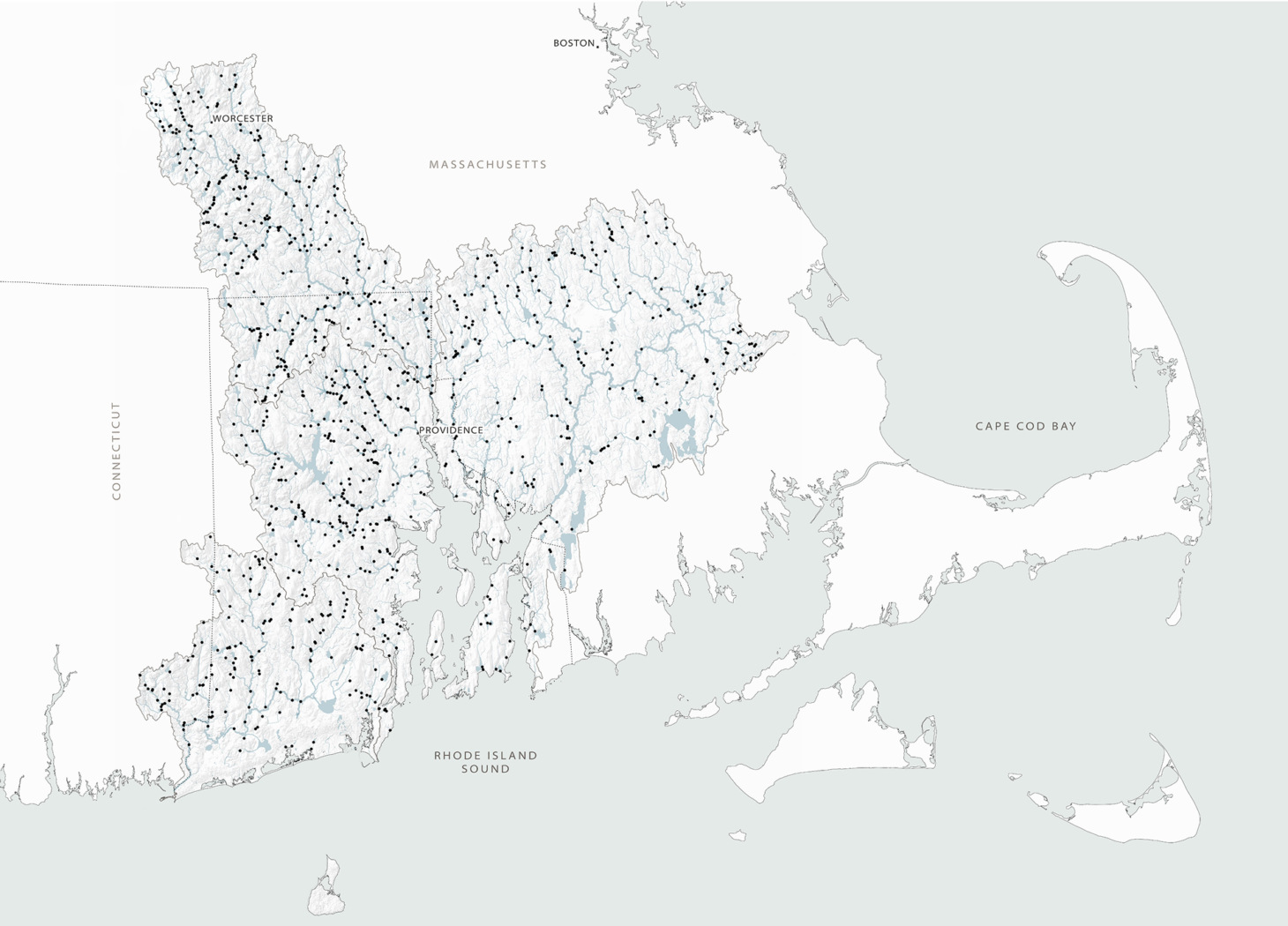
Dams in the Narragansett Bay Watershed
They are not monumental feats of engineering like Hoover Dam, nor are they part of large-scale hydrological water supply projects such as Shasta Dam, nor can they power whole cities like Grand Coulee Dam. Many New England dams are between 5 and 15 feet tall, no longer serve a purpose, and are nearing the end of their life cycles. Yet, these “legacy dams” continue to have dramatic impacts on freshwater and coastal ecosystems. They are fixed objects in a fluid and dynamic landscape, preventing the passage of migratory fish and altering nutrient and sediment flows between freshwater and coastal ecosystems. Additionally, with shifting climate regimes, dams pose an increased flooding risk to adjacent communities and present a hazard to downstream areas should they breach.
Aging infrastructure, shifting climate regimes, and large storm events have heightened these concerns, as an increasing number of dams are at risk of breaching and threatening downstream communities. In addition to addressing these safety concerns, future decisions about these dams present one of the greatest opportunities for large-scale restoration of New England rivers since the Clean Water Act became law almost fifty years ago. These decisions have the potential to improve habitat connectivity for endangered and threatened migratory fish, such as salmon, herring, shad, and eels, and to improve water quality while restoring the flow of sediments and nutrients that support critical freshwater and coastal habitats.
Since the 1990s, there has been a push by environmental organizations and public agencies to remove old dams to restore the ecological and hydrological connectivity of rivers. From an ecological, economic, and/or safety perspective, it often makes sense to remove legacy dams. But many policymakers and agencies have been ill-prepared for the unexpected resistance from community members. Dams, and in some cases their associated reservoirs, have become a significant part of the individual and collective sense of place in rural New England communities.
Dams and reservoirs are landmarks within an otherwise unstructured forested landscape. They are places where people grew up fishing with their grandparents, landscapes people drive or walk by every day, and features that have led to higher property values. In some cases, the dams are on the town seal in recognition of the village’s colonial and industrial history. To many, these dams are seen as a symbol of cultural and regional identity. However, these dams also tell a story of Native American cultures, who depended on the rivers for fishing and transportation, and whose peoples were massacred and lands stolen to make way for the progress of European settlers.
Even though New England dams are small, public meetings to discuss the future of these dams are often controversial, with people coming out to defend both sides. At one such meeting, a gentleman from the Swift River watershed in Massachusetts said, “If you kill the dam, you are killing a part of me.” These complex social dimensions have resulted in the delay or cancellation of over 50 dam removal projects in New England. Beyond the threat to cultural landscapes and sense of place, communities have also expressed resistance to outside agencies and authorities, who they feel come into their community— often with the intent and resources to remove a dam — and ignore local concerns, values, and desires.
These controversies raise important questions about how the public should be involved in decision-making about the management of rivers, coastlines, and other common-pool resources. Many people advocate for environmental democracies, where communities have the right to make decisions about the future of their surrounding environmental resources, water included. However, there are limited examples of how to actually achieve this in our complex contemporary society. If the goal is community control, we have to define “community” and include all voices in the decision-making process. How do we ensure that Indigenous communities, such as the Nipmuc and Narragansett, who traditionally depended on the rivers as fishing grounds, are heard within the predominantly white cultural context of rural New England? How are the needs of non-human species, such as salmon and herring, factored into decision-making? How do you build the participation necessary to be representative of the broader community and not just capture the opinions of outspoken individuals?
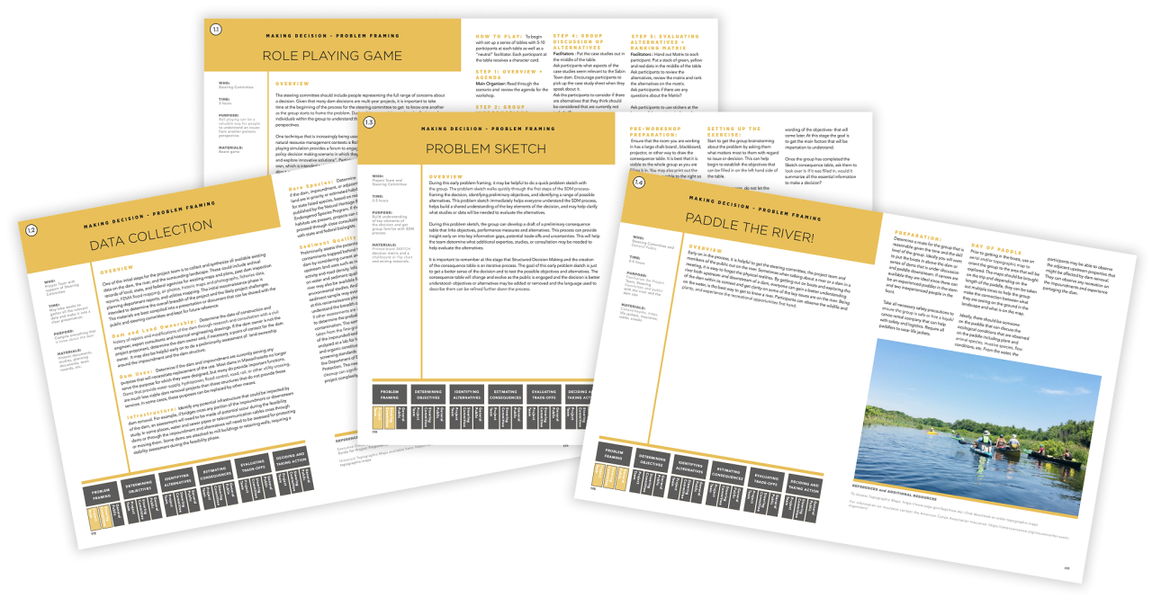
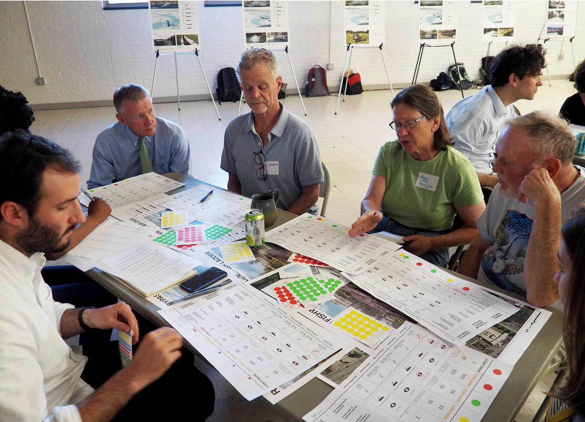
In response to these complex questions about how the public is brought into (or excluded from) the dam decision-making process, a team of faculty from the Department of Landscape Architecture at the Rhode Island School of Design worked with colleagues from across the region to design a process for engaging communities in discussions about the future of their dams. Integrating methods from community design workshops with an environmental decision-making method called Structured Decision Making, the group aimed to create a structured way for communities to discuss their values, as well as scientific facts, and evaluate the trade-offs around various future scenarios.
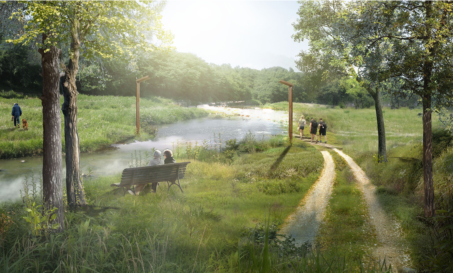
Because many New England dams are small, a range of approaches exist to improve habitat connectivity while allowing the dam and/or impoundment to remain in place. One option is a nature-like fishway, which involves raising the entire downstream width of the riverbed to gradually meet the height of the dam. Another approach is to construct a new river channel that bypasses the existing dam. While often more expensive and of uncertain effectiveness, alternatives like these help communities move beyond the binary choice of keeping or removing a dam. They can support multiple goals—from improving fish passage and water quality, to maintaining recreation on reservoirs, to preserving historic dam structures. In addition to these structural alternatives, the design team has been exploring ways to maintain or enhance a sense of place when dams are removed. These include installing structures that mark the location of former dam structures, managing vegetation to preserve open views, or using constructed water features to evoke the aesthetic experience of the original dam. Rather than erasing the layered histories of these sites or attempting to restore the river to an elusive pre-colonial state, the sites can be recognized as constructed landscapes—and reimagined to meet contemporary and future social and ecological goals.
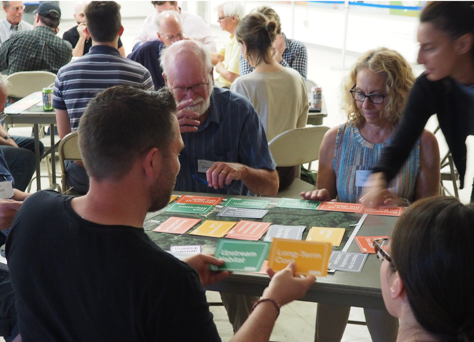
One of the results of this work is a decision-making toolkit that includes a set of “trade-off” cards to help individuals discuss their values, a set of “alternative” cards that describe and help visualize possible future scenarios, and a matrix that compares the social, ecological, and economic impacts of the dam alternatives. The toolkit relies heavily on visual graphics to help make scientific reports, quantitative data, and future alternatives more succinct and accessible.
The goal of this website is to share this work and support communities who are making decisions about the future of a dam. Decisions about dams are inherently complex and require the consideration of ecological, social, safety, engineering, and economic trade-offs. While there are many great resources and publications for proponents of dam removal, this website aims to provide an unbiased source of information on the ecological and social considerations associated with dam decisions. Rather than advocating solely for removal, the goal of this approach is to bring a community into an open conversation to think creatively about the future of a dam. While this may seem counterintuitive if your role is to advocate for dam removal, engaging communities in an open but structured discussion about the future of a dam has the potential to lead to both better environmental outcomes and a more engaged community— one that has more ownership, connection, and sense of stewardship over their river. In addition, this approach has the potential to address what are often perceived as unequal power dynamics between dam removal proponents and local communities, which has led to projects stalling or failing in the past.
This website consists of four main sections: The first chapter, “Understanding Dams,” introduces key ecological, social, infrastructural, and economic factors that are important to consider for the management of dams at the individual and watershed scale. The second part, “Scenarios & Case Studies,” looks at various alternatives for the future of a dam and presents a series of case studies on projects throughout the region. The third chapter, “Making Decisions,” shares methods, ideas, and tools for how to engage in conversations about the future of a dam. The last section, the Interactive Dam Atlas, was developed in collaboration with faculty from the University of Rhode Island and helps to visualize and build a geographic understanding of dams in the Narragansett Bay and Rhode Island coastal watersheds.
While this Dam Atlas is focused on dams in the Narragansett Bay and coastal watersheds of Rhode Island, the metrics calculated in the GIS analysis can be applied to other watersheds, and the decision-making tools are not region specific. By sharing our methods and the open-source decision-making support toolkit, the aim is to help support practitioners and communities that are looking for ideas, methods, and techniques for having discussions about the future of a dam. We encourage others to use, test, modify, evolve, and share these methods. Ultimately, the goal is for this work to contribute to a library of approaches that are openly shared to build knowledge and techniques to support collaborative environmental decision-making around dams.
As thousands of New England dams approach the end of their lifecycles, the region’s residents, citizens, policymakers, and leaders face a choice: to act reactively, waiting until the next big storm threatens the safety of our communities, or to take proactive steps now. If we wait, we risk future breaches, destruction, and displacement—communities forced to take emergency measures and make costly patchwork fixes. Or we can treat this moment as an opportunity—for proactive community decision-making that reclaims our rivers as a commons and brings people together at the local level to compassionately discuss divergent viewpoints; to critically reevaluate history, science, and personal values; and to think creatively about the collective human and more-than-human lives that depend on our rivers.